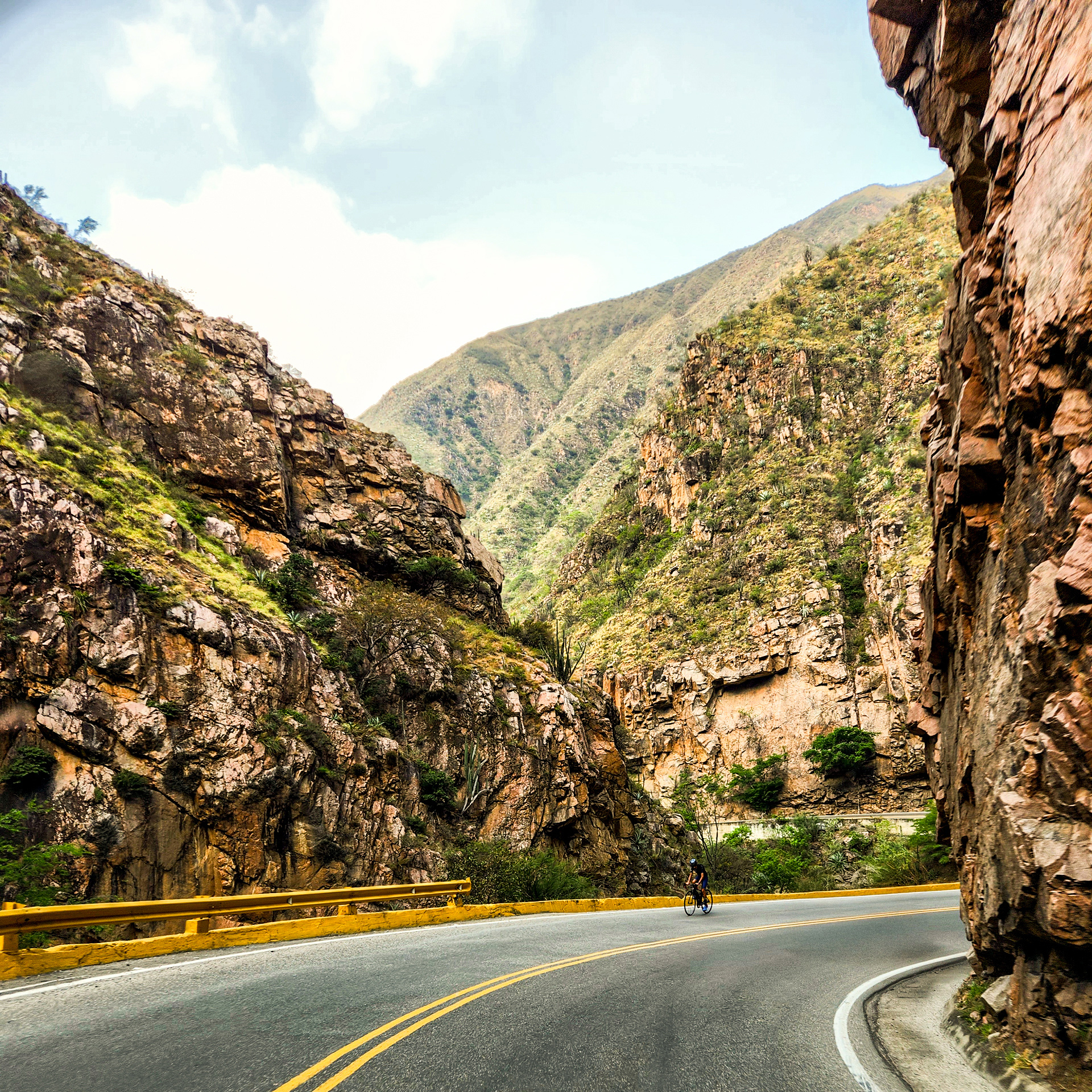
It's one thing to drive on rough roads, at least they are predictably bad. The roads in Colombia ambush you. There are nicely paved sections for miles, then, all of a sudden, an unavoidable collection of craters show up. You get lulled into a false sense of security. Colombia was pummeling my truck's engine and suspension. Progress was slow, but the views were incredible.
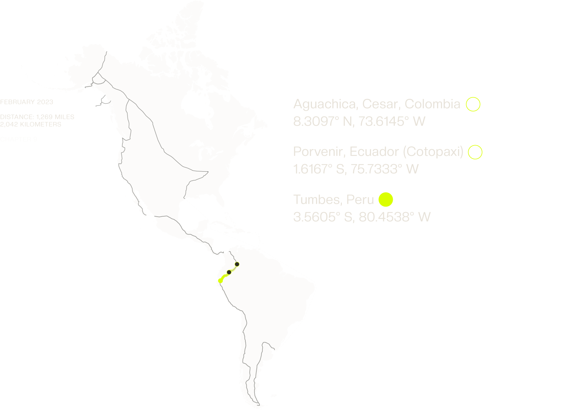
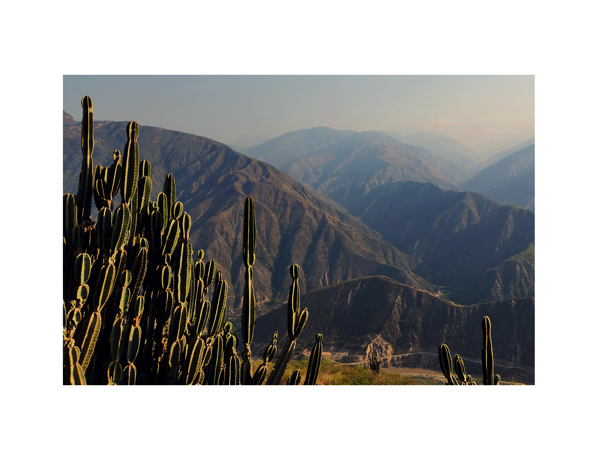
I deviated from the Pan-American route and headed toward Chicamocha Canyon, a dry, steep, cactus-filled landscape. Being on the western side of Colombia turned out to be a stroke of luck, as recent heavy rains caused a massive landslide which blocked the traditional Pan-American route. I continued on through Bogotá and stopped outside San Agustín. That night, I found a farmhouse to stay at. My room overlooked the Magdalena River. The next day, I drove to San Miguel, the last town with fuel and groceries before reaching Ecuador. That night, my room had no glass in the windows, only bars. I took a shower and went to bed.
Out of the corner of my eye, I saw someone waving frantically at me. It was a construction worker. He told me that the bridge had collapsed because of a mudslide.
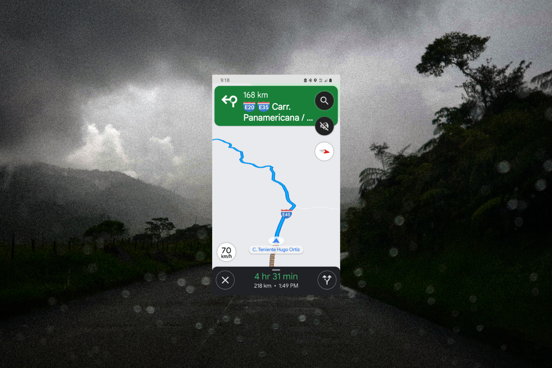
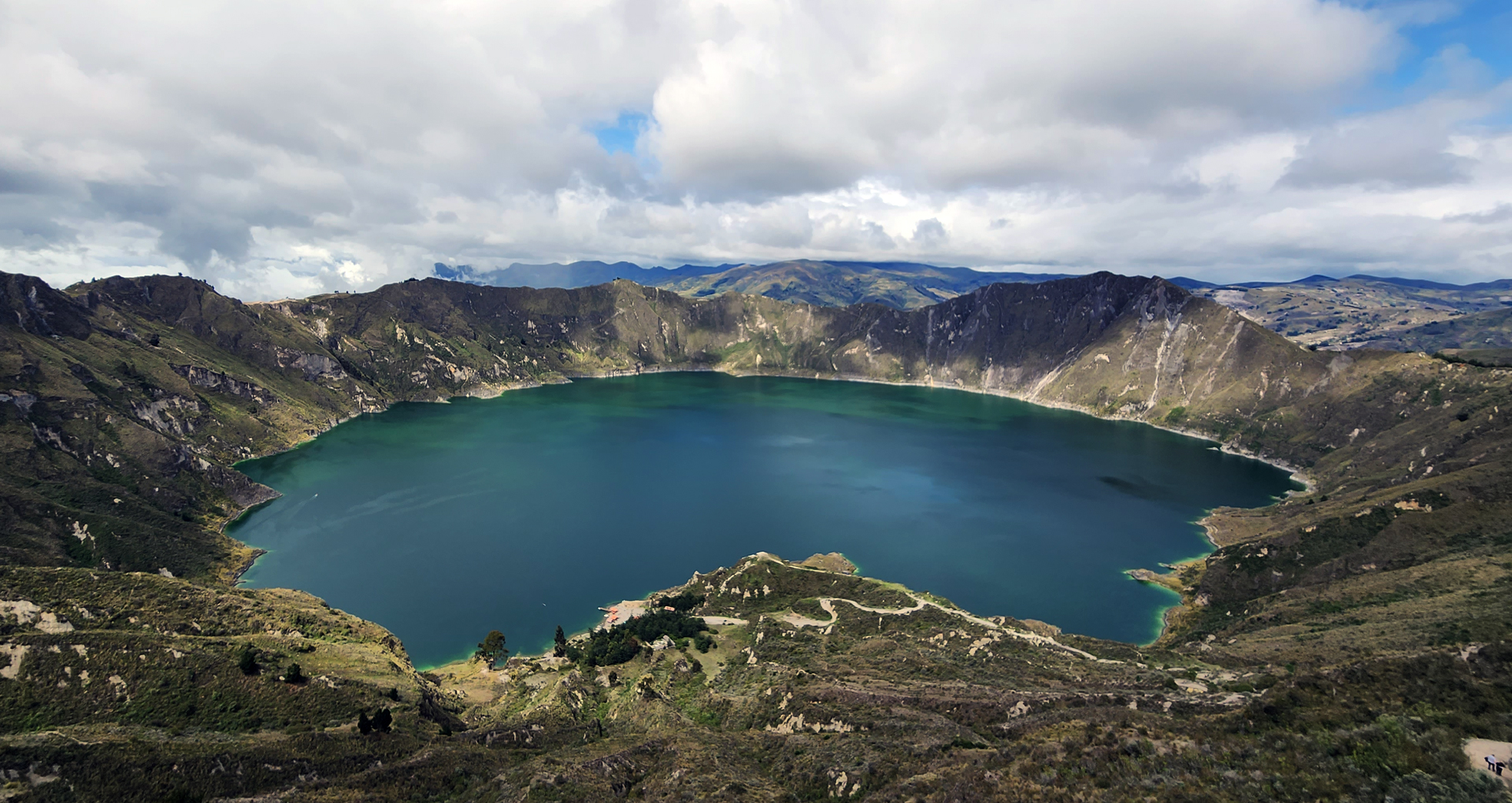
I was up early and at the Ecuador border as soon as it opened. Another border crossing success. The plan for the day was a six-hour drive to Porvenir, Ecuador, which is located near Cotopaxi Volcano. While a six-hour drive might sound long to some, at this point in the trip, it felt like a leisurely stroll. The satellite navigation in my Toyota had stopped displaying road maps and instead only showed longitude and latitude numbers. That day, the screen read Lat.: S0°0'0". I had crossed into the Southern Hemisphere. I was feeling pretty proud of myself in that moment, but as I turned a corner, I was suddenly faced with a massive excavator blocking the road. Not sure what to do, I started to slowly pass it. Then, out of the corner of my eye, I saw someone waving frantically at me. It was a construction worker. He told me that the bridge had collapsed because of a mudslide.
I pulled up Google Maps to look for another route. The construction worker grabbed my phone, zooming way out to show me the way. He pointed to the town where I'd need to turn. I needed to backtrack for three hours. What had started as a six-hour journey turned into an exhausting twelve-hour haul. By the time I reached my campsite in Porvenir, it was pitch black. When I got out of the truck, I felt a little light-headed. I assumed it was because of the long day of driving. Then I realized it was because I was nearly 12,000 feet above sea level.
I continued to opt for the more scenic mountain passes despite the unknowns. A few smaller rockfalls and the occasional crumbling road edge didn't slow me down, until I reached a sign that read Puente Cerrado (Bridge Closed). I brought the truck to a complete stop. I noticed dusty tire tracks veering off the asphalt. I decided to follow them, leading me down a dirt road that wound through the canyon and eventually reconnected with the highway. In just one day, I had traveled from snow-capped mountains to the sandy roads of Huaquillas. Again, it was getting late in the day, so I started looking for a place to sleep. I found a cheap hotel with gated parking just as a collection of dark storm clouds rolled in. That night, the rain was so intense it flooded under my hotel room door.